Ilmenau Science Night and Max Planck Day 2023

Ilmenau on the evening of July 1, 2023. People glance at their mobile phones to check if they’ll need an umbrella due to the weather. But is that all? No!

Some of them look at their phones to read about a pink-blooming wild plant: Epilobium angustifolium, it says, the Narrow-leaved Willowherb. Belongs to the Evening Primrose family and grows at the forest edge. Or Hypericum perforatum, the Common St. John’s Wort. “I know that as tea! So that’s how it looks?” Yes!

These situations and many similar ones were experienced as, on July 1, 2023, the doors of (among others) the Zuse Building at TU Ilmenau opened for Ilmenau Science Night, and many interested people came by to “personally meet Flora Incognita.” And we were well-prepared: With blooming wild plants in pots, an app quiz, and botanical tours around the university campus, but also with advanced offerings like microscopic examination of phytoplankton or information stands that explained how the Artificial Intelligence behind Flora Incognita is already being used to identify field wildflowers through drone images, or to support urban planners in creating bee-friendly landscapes.

Another focus of our presentation was to educate about how we conduct research with the plant identifications from the Flora Incognita app. Our scientists were eager to point out that the data already allows for the detection of phenological shifts in plant flowering phases, or that the spread of invasive species like Impatiens glandulifera can be monitored. In light of ongoing climate change, such information is very valuable; and with Flora Incognita’s new project feature, it’s easy for nature enthusiasts to conduct their own citizen science projects and analyze the observation data collected.

It’s always something special to engage with long-time fans and learn which aspects of the app are particularly popular and which ones have room for improvement. But we’re equally proud when we can dispel skepticism and encourage people to simply try out the app and start identifying plants. Fun Fact: Secretly, we like to count how many new installations we can achieve through our on-site efforts at such events!

But it’s not just in Ilmenau where we could convince: Also in Göttingen, where on June 23, in honor of the 75th anniversary of the Max Planck Society, Max Planck Day took place, we were present with an information booth on the marketplace. Unfortunately, due to persistent rain, not many people were out and about, but that allowed us to engage in longer and more intense conversations with interested individuals about our app, the loss of biodiversity, and our research work. In Göttingen, we were joined by scientists from the ATTO Tower (MPI for Biogeochemistry Jena and MPI for Chemistry Mainz), who invited attendees to climb the measurement tower in the Amazon rainforest and talk about their climate research using a VR station. A special highlight of the day was the visit of Prof. Patrick Cramer, the new president of the Max Planck Society, to our booth.

At this point, we would like to extend a heartfelt thank you to everyone who took the time to convey praise and criticism, ask questions, and be curious. Thanks also to Manuel Maidorn and the staff of the Max Planck Institute for Dynamics and Self-Organization in Göttingen for providing the many plants at the booth! Our gratitude also goes to our sponsors who make this public outreach possible.

See you soon!

collage of pictures taken at both events. They show our team on site, visitors on the booths, and plant identification with the Flora Incognita app.

Title image: Max Planck Society, photograph by David Ausserhofer

How to export your Flora Incognita records to a custom map (Google Maps, QGIS and R)

We get asked quite often of whether one can view the personal plant observations outside of the Flora Incognita app, for example in Google Maps or a Geographic Information System (GIS). The answer is simple: Yes, you can! In this article, you will find three tutorials for that – depending on your use case.

Exporting your data out of Flora Incognita

Regardless of the method you choose, first, you need to export your observations from the Flora Incognita app. To do that:

1) Open your observation list under My Observations from the home screen and tap on the Share icon at the top right.

2) You can now transfer either a .csv file or a .gpx file to your computer using various methods.

3) If you want to export your observations including the images, we recommend that you first filter the observation list to reduce the number of observations to be exported. The reason for this is the enormous increase in file size caused by the images.


Exporting Flora Incognita observations to Google Maps

With this method, you can view your findings in Google Maps on the desktop without requiring any additional software.

  1. Go to https://www.google.com/intl/en/maps/about/mymaps/ and start a new project under Get Started.
  2. Click on the Owned tab and select Create a New Map. You will get a blank map with its own context menu:
  3. Under Untitled Layer, click on Import and choose the previously exported .csv file.
  4. In the following menu, select the latitude and longitude columns. Click Continue.
  5. Now choose how your data points should be labeled. Choose name for the common name or scientific name for the scientific name. Click Finish. Note: The points are now marked but the labels are not visible yet.
  6. In the menu window, click on Uniform Style and choose the name you want to display under Label.
  7. Under Base Map, you can customize the underlying map as desired:
  8. Further individual adjustments are possible under the available menu options. Clicking on a data point will display the transferred meta-information.

Exporting Flora Incognita observations to QGIS

QGIS is a professional GIS application developed based on Free and Open-Source Software (FOSS). Choosing this option is useful if you work professionally or in your free time with GIS.

  1. Open QGIS and create a new project (Project -> New).
  2. In the left menu, select your map base layer under XYZ Tiles by double-clicking. In our example, we use OpenStreetMap. You can now zoom into the map.
  3. In the main navigation, select Layer -> Add Layer -> Add Delimited Text Layer.
  4. Choose your previously exported .csv file and check the extracted file format for the following parameters:
    • File format: CSV (comma separated values)
    • Geometry definition: X field: longitude; Y field: latitude
    • Geometry: EPSG:4326 – WGS 84

    Your data should look like this:

  5. Click Add at the bottom right and close the window. Now you will see your discoveries in the map, but still without labels. Learning how to customize your findings is the next step.
  6. Right-click on your Flora Incognita layer in the Layer panel to the left of the map. Select Properties.
  7. Under Label change the setting from No Label to Single Label. Under Value you can choose whether you want to display the scientific or the trivial name. Confirm with OK. The result looks like this:

Exporting Flora Incognita observations with R

R is a free programming language for statistical calculations and graphics. To follow this guide, you need to execute prepared scripts using the appropriate software. Basic knowledge of R is required.

  1. Go to https://www.r-project.org and install the latest version of the R program.
  2. Go to https://posit.co/products/open-source/rstudio/ and install the latest RStudio.
  3. Install and load the necessary libraries.

    install.packages("leaflet")
    install.packages("leaflet.extras2")
    install.packages("htmlwidgets")


    library(leaflet)
    library(leaflet.extras2)
    library(htmlwidgets)
  1. Read your .csv file.

    dat<-read.csv("/your/path/your_file.csv", header=TRUE)
  1. Create and load the map. Closely located observations are clustered.

    map1 %
    addProviderTiles('OpenStreetMap.Mapnik') %>%
    addCircleMarkers(lng = ~longitude, lat = ~latitude,
    label = ~scientific.name, radius=7, labelOptions = labelOptions(style = list("color" = "black"),
    noHide = T, textOnly=T, textsize = "10px", offset = c(1, 12)),
    color="black", clusterOptions = markerClusterOptions(spiderfyOnMaxZoom=T))

    map1
  1. Add the plant findings to the map. To display the trivial name, replace “scientific.name” with “name”.

    map2 %
    addProviderTiles('OpenStreetMap.Mapnik') %>%
    addLabelOnlyMarkers(lng = ~longitude, lat = ~latitude, group="labs",
    label = ~scientific.name, labelOptions = labelOptions(style = list("color" = "black"),
    noHide = T, textOnly=T, textsize = "10px", offset = c(1, 12))) %>%
    addCircleMarkers(lng = ~longitude, lat = ~latitude, color="black") %>%
    addCircleMarkers(lng = ~longitude, lat = ~latitude, radius=2, label = ~scientific.name, color="white")
    addLabelgun(map2, group="labs")

    map2
  1. Export your map as an .html file
    saveWidget(map2, file="/yourpath/map.html")

    Screenshot from the map generated with R. Three plant findings are visible in a lake landscape.

You can also download the guide as a text file: R_MapExport_EN

Two hands hold a smartphone over a flower-rich meadow. The smartphone display shows the Flora Incognita App.

Press Release: New AI for Flora Incognita

“Flora Incognita”, Germany’s most popular plant identification app, has been further enhanced by a new artificial intelligence (AI) – as a result, the number of identifiable plant species has tripled: around 16,000 species can be identified worldwide. The app, available in 20 languages, now also works offline. Its range of digital educational content has been significantly expanded to include a wide range of new plant information.

Scientists from the Technical University of Ilmenau and the Max Planck Institute for Biogeochemistry in Jena have improved Flora Incognita with a new technological basis of self-learning, deep neural networks. Prof. Patrick Mäder, head of the Department of Data Intensive Systems and Visualisation and project leader of Flora Incognita at the TU Ilmenau, and the research team from Jena have made great efforts to develop innovative machine-learning training methods for these networks in the last months: “We immediately applied the new methods to the Flora Incognita app and were thus able to process millions of images of plants worldwide in our data center at the TU Ilmenau. With the right images, the new networks are able to classify many plant species with an accuracy of almost 100 per cent”.

For the new app version, user-friendliness and accessibility have also been improved. Plant finds can now be captured offline in nature, i.e. without a network connection, and automatically identified later (with internet access). Germany’s most popular plant identification app is also used by teachers at schools and universities to support education. Since school devices rarely have mobile internet, in particular this target group benefits from the new offline mode.

In addition, a new gamification element has been introduced: Users can collect badges for documenting certain plant groups. With this, they not only enjoy collecting plants themselves over a longer period of time,but they also strengthen the awareness of biodiversity in their social environment. At the same time, the app creates an incentive to document already known species or other plant groups, which provides scientists with important data for their research projects.

Another new feature is the possibility to use Flora Incognita for citizen science projects. Lay people involved in the project can identify plants as usual, for example, invasive species of a region, special trees, or the plant diversity of a school campus.  Those responsible for the citizen science project then receive the anonymized observation data for scientific and nature conservation evaluation.

But not only the technology of the Flora-Incognita app has improved. The data basis and the underlying information have also been expanded. Citizen scientists, i.e. interested laypeople, have contributed to this. With the “Flora Capture” app, which was specially developed for the scientific documentation of plants, thousands of images from defined perspectives have already been transmitted, which have contributed to a significant improvement in the identification accuracy of the German flora, especially for critical plant groups such as grasses. Students of the University of Applied Sciences Erfurt participated in the recording of thousands of trees, so that now identification is also possible in winter on the basis of bud images. The authors of the book “African Plants – A Photo Guide” and members of the Geisenheim University of Applied Sciences and the Dresden University of Applied Sciences provided further important data for the expansion of the identifiable species.

Co-project leader Dr. Jana Wäldchen from the Max Planck Institute for Biogeochemistry Jena announces that the additional information offered in the app will be further expanded in the coming months: “We plan to supplement the plant fact sheets with additional exciting details. For example, we are thinking of information on how pollinator-friendly a species is or whether it is invasive. In this way, we would like to provide our users with interesting plant knowledge after the identification.

Flora Incognita now with offline mode

With our latest release of the Flora Incognita app, we are happy to give you two updates that many have asked for, in addition to numerous small bug fixes:

  • an offline mode
  • badges for 2023

An offline mode for Flora Incognita

Often, the most exciting plants grow where there is no internet coverage, or teachers want to use the app in an educational context, but the need for a mobile data connection makes this impossible. Now we have a solution for this: the offline mode. What does it do?

It allows you to record plants with the Flora Incognita app and save them as observations. However, you do not receive a plant name, but the observation is saved as “unknown herb or shrub”, “unknown tree”, etc. in your observation list. This also corresponds to the process that botanists would follow: What is not identified in the field is packed up and identified later. This is now also the case with the app. When you are back home (or somewhere with access to the internet), you can identify the unknown observations with a click and read the species fact sheets of the plants you have found – as usual.

By the way: Plants identified in offline mode also contribute to the worldwide monitoring of plant diversity – provided you have allowed Flora Incognita access to your location. In this case, the location of the plant is stored as meta-information at your observation.

Badges 2023

The introduction of the badges last year brought great joy to many users, and right in the first days of the new year we received many e-mails whether there will also be new badges for this year. Yes! They are now ready and waiting for you to collect them:

– Plant of the Year 2023: Collect the common self-heal (Prunella vulgaris)

– Tree of the Year 2023: Collect a brown birch (Betula pubescens)

– Poisonous Plant of the Year 2023: Collect parsley (Petroselinum crispum)

– Medicinal Plant of the Year 2023: Collect a vine (Vitis vinifera)

– Plant Society of the Year: Collect a representative of the Littorelletea uniflorae community

Have fun!

If you enjoy our app and plant identification, we would be very happy to receive a rating and a few kind words in the App Store. Thank you very much!

“The advancement of AI methods will create key momentum for environmental and biodiversity research”

Interview with Prof. Patrick Mäder about the interaction of computer science, biology and Big Data

As a young research group at TU Ilmenau, the Data-intensive Systems and Visualization Group (dAI.SY), with currently more than 20 scientists and many student collaborators led by Prof. Patrick Mäder, combines diverse expertise in computer science, engineering and related scientific fields. In addition to machine learning and reliable software, biodiversity informatics has emerged as a focus of the department in recent years. In this way, the research team aims to contribute to the preservation of biodiversity. UNIonline spoke with Prof. Mäder about research in this area.

With your research focus on biodiversity informatics, you are working at the interface of computer science, biology and big data, thus bringing together the topics of digitization and sustainability. What motivated you to conduct research in this area and specifically on the topic of biodiversity?

In 2006 and 2012, I participated in expeditions to Siberia lasting several weeks under the leadership of Prof. Christian Wirth, the founding director of the German Center for Integrative Biodiversity Research iDiv, and Prof. Ernst-Detlef Schulze, founding director of the Max Planck Institute for Biogeochemistry. Together we conducted ecological research under adventurous conditions that was very memorable and changed my awareness of biodiversity: Climate change is a major threat to humanity, and biodiversity loss goes hand in hand with it. We need to stop thinking in silos and bring together the expertise of different scientific fields to study these complex relationships, understand them, and develop foundations for solutions. Our Flora Incognita project is doing just that.

Until recently, biologists did not have access to very large amounts of data to analyze. However, this has changed in recent decades, allowing researchers like you to use these data to investigate ecological questions. What kind of data are you working with?

We work with very different types of data, primarily photos, but also location data, multispectral image data that capture more than the three color channels perceivable by humans and thus information not visible to the human eye, and point clouds , which arecollections of very many measurement points generatedby laser scanners. Probably best known are the observation data that we have been using for years for automatic plant identification in the Flora-Incognita app: Millions of users worldwide ensure every day that we can link image evidence of plants with their locations, enabling us to analyze and predict the distribution of species.

This information is supplemented by curated observations from selected experts via the Flora Capture app. But our research group is not limited to plants. We process microscopic image data for the detection of phytoplankton and insects. In addition, we use special multispectral image data for the automatic identification of pollen. And for evaluating forest stands, we use point clouds generated with LIDAR sensors, a method related to the Radar related method for optical distance and speed measurementWith such data, we can then, for example, make statements about the water quality or help make urban areas more bee-friendly.

As part of the interdisciplinary research group KI4Biodiv – Artificial Intelligence in Biodiversity Research, you would like to work with the Max Planck Institute for Biogeochemistry to further develop and improve these AI methods and technologies in order to monitor biodiversity in different habitats and landscapes efficiently, quickly and automatically. To what extent is biodiversity monitoring a particular challenge for you as a researcher?

To understand the challenges, we first need to look at what biodiversity monitoring means in the first place: it allows us to perceive and document changes in the spatiotemporal occurrence of species. This includes, of course, the distribution of species: Where is diversity declining, where is it increasing? But biodiversity monitoring also includes other things, such as phenology: when do plants bloom, when do they bear fruit, and when do autumn leaves turn colorful? Such monitoring data indicate changes in biodiversity, they are used to investigate the causes of these changes, and they indicate whether strategies and measures to protect biodiversity are working.

Of course, such monitoring also poses major challenges, especially in three areas: it is expensive, requires a lot of time, and requires excellent taxonomic knowledge. Thus, numerous methods and concepts are needed to conduct effective biodiversity monitoring and to overcome the above-mentioned challenges – which is why automated recording and evaluation methods are the focus of research.


Foto: TU Ilmenau/ari

Interview:  Technische Universität Ilmenau

Promote cultivation of wild fruit

In the Wild Fruit Project of the Austrian Federal Forest Research Center (BfW), measures are being taken to secure and maintain the biodiversity of rare, native wild fruit trees in Austria – an opportunity for silviculture and biodiversity in times of climate change. The Flora Incognita project provides important distribution information on endangered wild fruit trees for this project.

For more information, please visit the following website:  https://www.bfw.gv.at/anbau-wildobst-foerderung/

Photo: BPWW/N.Novak

Digital beekeeping to learn and play

With the “beeactive” app from the Würzburg Bee Research Association, children and young people can playfully learn more about bees and the biodiversity of various wild plants in their environment. The aim is to bring nature conservation and species protection into focus and to broaden their awareness of this. Flora Incognita provides the automatic identification of plant species as an important game content of “beeactive”.

The core principle of the app “beeactive” is the playful accompaniment of the virtual beekeeper Melli Fera and thus the establishment and care of digital bee colonies. Users can place individual beehives on an interactive map and search the real surroundings of the bee colony for flowering plants within a certain radius. The plants found are then automatically identified directly by the app. In this way, the virtual bee colony is supplied with pollen and nectar and the users can expand their knowledge of the species at the same time. The higher the number of plant species found, the better the digital bee colony develops and new hives may be added. In this way, users can also be motivated to sow their own bee-friendly flowering meadows. In addition, they support the creation of local and regional flowering maps with the numerous plant photos. The game is supplemented by a wide range of information on the ecology of honey bees and wild bees, as well as on the basics of ecological relationships. An integrated quiz allows direct application of the new knowledge and consolidates what has been learned.

For more information, please visit the following website: https://beeactive.app/.


The app “beeactive” was developed by Porf. Tautz and Florian Schimpf and financed with funds from the Bayerische Sparkassenstiftung. It is available free of charge in the Google Play Store and the Apple App Store.

Automated plant identification with the Flora Helvetica app

We are pleased to announce a successful collaboration with Haupt Verlag. Since version 2.3, the Flora Helvetica app includes a function for the automatic image-based identification of plants, which is provided as part of the Flora Incognita project. Thus, for the first time, it is possible with a single app to identify plants automatically as well as manually with the integrated identification key.

For more information about the Flora Helvetica app, please visit the following page:

https://www.flora-helvetica.ch/app

Kosmos „Was blüht den da“ in our Flora Incognita App

„Was blüht denn da?“ –  always mobile!

All buyers of the current edition of the two books “Was blüht denn da? Das Original” and “Was blüht denn da? Der Fotoband” have the possibility to have the contents of their “Was blüht denn da?” with them on their smartphone.

After entering a code in our identification app “Flora Incognita”, the corresponding texts and images will be displayed for all plants included in “Was blüht denn da?”.

For further questions please contact directly KOSMOS.


„The only things you want to conserve are the things you know”

Jana Wäldchen and her team from the Max Planck Institute for Biogeochemistry have played a key role in developing the plant identification app, Flora Incognita. We discussed with her how being able to identify different plants contributes to species diversity, which plant species are particularly under threat and how non-native species are suppressing local plants.

What role do Citizen Science projects such as Flora Incognita play in protecting the variety of species?

Projects such as Flora Incognita that involve the general public play two important roles. On the one hand, they simplify the identification process. Anyone who is interested in plants can now easily, quickly and fairly precisely put a name to an unknown species. This means that more attention is paid to plant variety and that people become more aware of nature and the need to protect it.

Naturally, documenting the variety of plant species also makes an important contribution. As a result, scientists and nature conservation authorities also benefit from the app. Thanks to the identified species and their location, extremely valuable data records can be created that provide information that is of relevance for research into species protection and biodiversity. In the long term, the data from the Flora Incognita app will make it possible to find new answers to questions such as: When do certain species flower, and where? How widely to the properties of a single plant species vary? How are the composition and locations of the plants shifting in response to climate change and the type of land use?

The Flora Incognita app has been in use for two years. What has changed during that time?

The goal of the project is to make it easier for people to identify plants, and in this way, to increase their awareness of the wide variety of species around them. We have received many emails and comments from users that confirm that we’re taking the right approach towards achieving this goal. We’re not just getting feedback about how easy it is to identify plants. Many users also write that this easy identification has broadened their view of the variety of species.

Comments such as “At last, we’re not just ‘blindly’ walking through the forest!” or “This is a fun way of finding out more about the environment” show that the app is making an important contribution towards raising awareness of plant diversity. It is very satisfying to have achieved this goal. Plant identification plays an important part in species protection, since we only want to conserve the things that we know. 

How does the app make plant identification easier?

It’s a situation we’re all familiar with. While out walking, you spot a plant that you wouldlike to know more about. What is the plant called, is it poisonous, or might it be a protected species? For laypersons, the standard identification books are difficult to understand; identifying the plants takes a lot of time and is usually difficult to do because so many specialist terms are involved. This presents a major hurdle for people who are interested in identifying plants and who want to find out more about them.

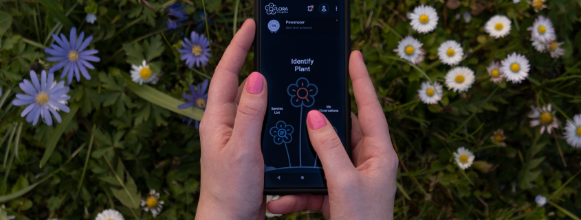
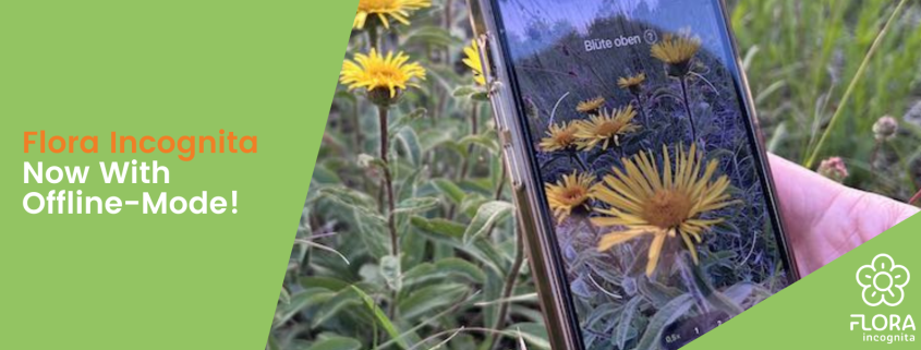
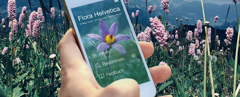
Picture guides have made it easier to identify the most common species, but either we don’t always take them with us, or they don’t cover the entire range of plant varieties. Our Flora Incognita app allows users to identify plants quickly, easily and fairly precisely. Using the camera in your smartphone, you take a snapshot of the flower, and possibly also the leaves, and in just a few seconds, the suggested name of the plant is shown. Users are also given additional information such as its local protection status, important plant features, areas where it is found and information about similar species with which it is easily confused.

How often has the app been downloaded? How many plants have already been identified using the app?

The app has been downloaded over a million times. It has already been used to identify more than eight million plants. To date, Flora Incognita has identified around 4,600 different species.

Can the app be used to draw conclusions about plant variety in specific ecosystems?

The plant observations collected using the app are not systematic and only reflect what the users see in nature, and what attracts their interest. This means that we only get information about which species are growing in specific areas. This does not enable us to draw conclusions as to whether certain species are not present. Those species that are common and striking in appearance are identified more often than the rarer, less spectacular ones.

Even so, after just two vegetation periods, we can determine similar patterns of spread for certain species to those identified in floristic, systematic mapping for the whole of Germany. This illustrates the potential for the app to supplement floristic mapping in the long term. We are very confident that this autumn, we will have collected sufficient observations to allow us to make more detailed statements about plant variety in different regions.

However, we can now already say that most identifications are made in urban areas, in the places very close to where people live. The species that are photographed most often are nitrogen indicators such as yarrow (Achillea millefolium agg.), dandelions (Taraxacum), ground ivy (Glechoma hederacea agg.) or garlic mustard (Alliaria petiolata), which mainly grow in anthropogenic habitats. At the same time, we have also noticed that people often use the app when they are away on holiday. For example, in 2019, observation figures were higher in relation to the size of the population on the North and Baltic Sea coasts and in the Alpine region than in other areas.

Which plant species are particularly under threat?

In Germany, nearly a third of native wild species are endangered. This is the figure given in the endangered species list of ferns and flowering plants, mosses and algae, which was published by the German Federal Agency for Nature Conservation in December 2018. Due to intensive farming, many species have declined significantly, such as the flame adonis (Adonis flammea), which grows in central Europe on chalky, shallow arable land. The round-leafed modesty (Bupleurum rotundifolium), which has similar soil requirements, has disappeared in many places.

Another group of species that is particularly under threat are plants that grow in non-cultivated, in particular low-nutrient, poor soil.  They include species such as the small pasque flower (Pulsatilla pratensis) and catsfoot (Antennaria dioica). However, typical moorland plants such as types of sundew (Drosea spec.) or bogbean (Menyanthes trifoliata) are also classified as endangered species. The main cause of the decline in numbers is the increasing addition of nutrients to the soil. As well as those plants that are included on the list of endangered species, there are also others for which Germany is responsible internationally for protecting, either because they only grow in Germany, or because their populations here are large compared to other countries. They include species such as the sycamore (Acer pseudoplatanus) and copper beech (Fagus sylvatica).

Which ecosystems need particular protection?

A particularly large number of species groups that are under threat or in danger of becoming extinct grow on low-nutrient soil, such as heathland, grassland, and moorland.  However, hay meadows rich in plant species, orchards, floodplains, alpine meadows and coastal dunes also need special protection.

Which neophytes grow particularly well in Germany?

Neophytes are plants that began to grow after 1492 in areas from which they do not naturally originate. In Germany, more than 400 neophytes have become firmly established. Of these, more than 50 species have been classified by the German Federal Agency for Nature Conservation as being invasive or potentially invasive. Many of us are familiar with common plants such as the Canadian goldenrod (Solidago canadensis), hill mustard (Bunias orientalis), Japanese knotweed (Fallopia japonica), giant hogweed (Heracleum mantegazzianum) and Himalayan balsam (Impatiens glandulifera).

These “invasive” non-native species generate problems for nature conservation and lead to economic damage by reducing crop yields, causing increased use of pesticides in agriculture and forestry, or making it more expensive to maintain roads, waterways and railway tracks, for example. Giant hogweed and common ragweed (Ambrosia artemisiifolia) also contain substances that cause burns or allergies among humans.

After habitat destruction, invasive species are regarded as posing the second-greatest threat to biodiversity throughout the world. Above all, invasive species compete with native species for habitat and resources. In doing so, they can suppress individual native species or even entire natural communities. One clear example for the area near where we work in Jena is hill mustard. It has spread like wildfire and is now pushing out native and rare plant species from the species-rich meadow and semi-dry grassland biotopes. Early detection and rapid response are critical processes to prevent the spread and establishment of invasive species.

How will the app be developed in the future?

While in recent years, we have mainly worked on the app and automatic identification, in the follow-up project, Flora Incognita++, our main aim is to evaluate the observation data. Here, studies are needed for automatic quality control. We also want to be able to draw conclusions about flowering periods, dissemination, and coexistence.

We have also not yet met all our quality standards when it comes to automatic identification. In the follow-up project, we will improve the detection algorithms specifically for species groups that are critical to identification, such as sweet and sedge grasses.

We are also working on our third app (Flora Key), which contains an interactive identification key and which enables manual identification on the basis of morphological properties of the plant. This identification key will also be integrated into the Flora Incognita app.

The Flora Incognita project is jointly funded by the German Federal Ministry of Education and Research (BMBF), the German Federal Agency for Nature Conservation and the Thuringian Ministry for the Environment, Energy and Nature Conservation, and will continue to take an application-oriented approach. An important goal of our research group will continue to be to forge links between science, the general public and the government authorities.

Many thanks for this interview!

Interview: Barbara Abrell (Max Planck Society)